Designing a Food Forest with Permaculture Mapping: An In-depth Guide
In the heart of bustling cities, a green revolution is taking place. The art of permaculture, long associated with rural and suburban settings, is now being adapted to urban landscapes, thanks to cutting-edge digital mapping tools and app-based solutions.
Permaculture, a sustainable farming method focused on creating self-sustaining ecosystems, is finding new life in cities. With its core focus on organic pest control, companion planting, and resource management, permaculture is proving to be an effective solution for urban food production.
Advanced GIS and 3D modeling software are key tools in permaculture mapping, improving resource management, biodiversity planning, and land use optimization. These tools help design food forests that can thrive in cities and nearby areas, optimizing garden layouts by considering zones, sectors, solar orientation, companion planting, and soil health.
One of the most recent advancements is the development of user-friendly apps and online platforms designed specifically for permaculture practitioners. These digital aids support mapping, seasonal planning, plant identification, and ongoing garden management, making urban food forest design more accessible than ever before.
Integration of zone and sector analysis is another key advancement. This approach arranges urban food forest elements according to energy use patterns and external climatic factors, such as sun and wind, enhancing productivity and resilience in compact city spaces.
Multi-layered agroforestry systems, employing plant guilds—mutually beneficial species groupings to create self-sustaining ecosystems—have also been refined in urban contexts to maximize yields with minimum external inputs.
Digital conceptual designs and digital layouts, often combined with innovative equipment, translate topographic and soil data into practical planting schemes for urban food forests and regenerative farms. Emerging mobile and web applications like “Gardens Across Iowa!™” democratize urban food forest design and management, facilitating community-led projects and real-time data use for optimizing growing conditions.
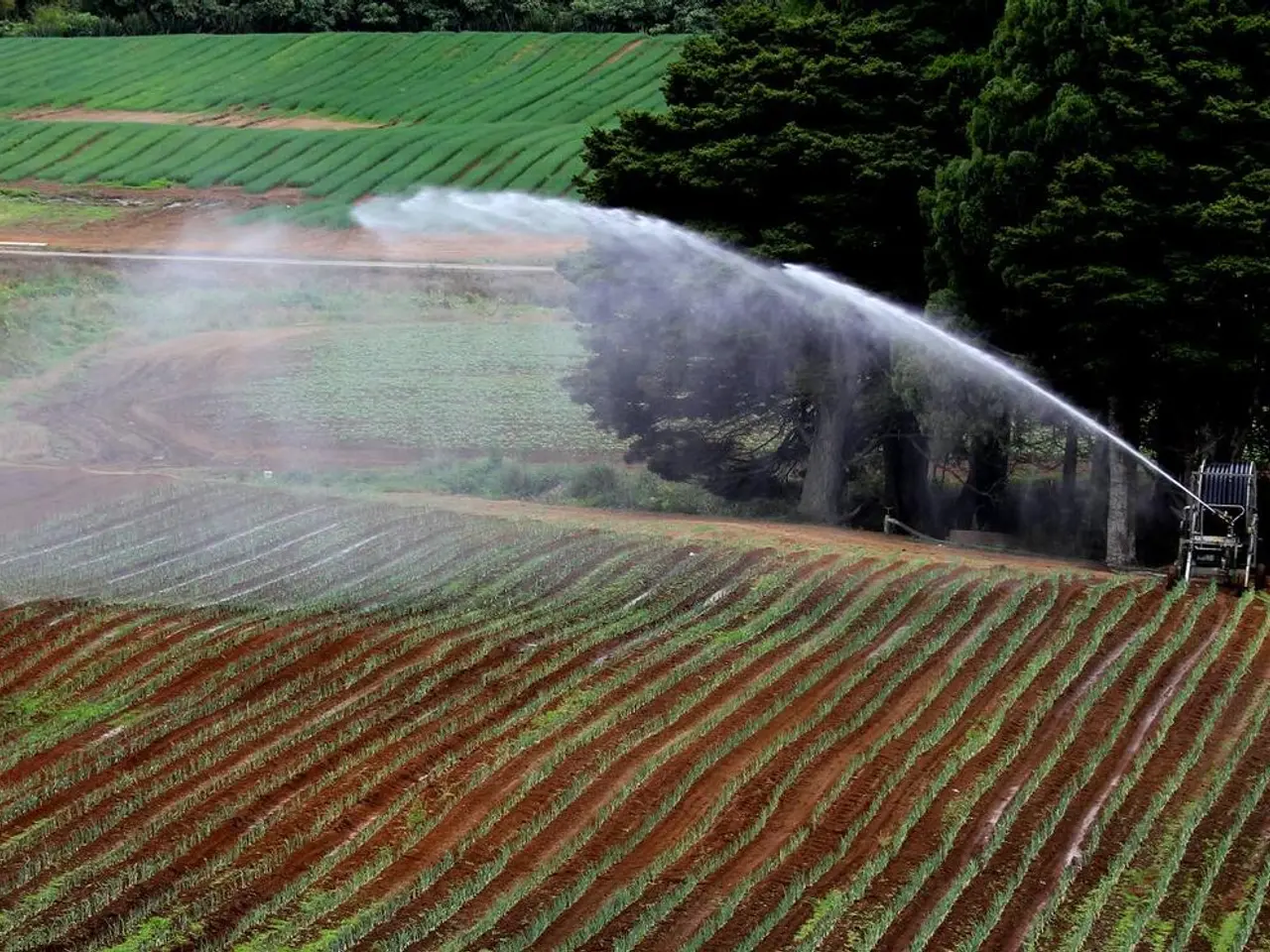
Crucial to the success of any urban food forest is a thorough site analysis, including soil testing and microclimate evaluation. Understanding a site's unique features, such as sun, wind, frost, and water drainage, is essential for designing a food forest for success.
Crop rotation, a vital sustainable agriculture practice in permaculture, helps improve soil fertility, suppress weeds, and prevent pests and diseases. Rainwater harvesting is also crucial, collecting rainwater for use during dry periods and reducing reliance on external water sources.
As the world's population continues to urbanize—with two-thirds expected to live in cities by 2050—the need for sustainable food production methods becomes increasingly urgent. Urban food forest permaculture, with its focus on resource management, biodiversity, and community engagement, offers a promising solution.
This course teaches the basics of permaculture design, including the use of new mapping and analysis tools. It covers sustainable practices like organic pest control, crop rotation, and regenerative agriculture for carbon sequestration, teaching students to maintain ecosystem health without harmful chemicals.
By leveraging advanced digital mapping tools and app-based solutions, urban food forest permaculture is transforming the way we think about food production in cities. These tools incorporate ecological design fundamentals, community engagement features, and practical resource management, helping practitioners efficiently plan, implement, and maintain complex urban agroecosystems.
- The art of permaculture, once limited to rural settings, is now being adapted to urban landscapes, utilizing cutting-edge digital mapping tools and app solutions.
- Permaculture, with its focus on companion planting and resource management, is proving effective for urban food production.
- Advanced GIS and 3D modeling software are key tools in permaculture mapping, improving resource management, biodiversity planning, and land use optimization.
- User-friendly apps and online platforms are designed for permaculture practitioners, supporting mapping, seasonal planning, plant identification, and garden management.
- Integration of zone and sector analysis arranges urban food forest elements according to energy use patterns and external climatic factors for optimal productivity and resilience.
- Multi-layered agroforestry systems employing plant guilds are refined in urban contexts to maximize yields with minimum external inputs.
- Digital conceptual designs and layouts translate topographic and soil data into practical planting schemes for urban food forests and regenerative farms.
- Crop rotation, a sustainable agriculture practice in permaculture, helps improve soil fertility, prevent pests, and manage water resources.
- Rainwater harvesting, part of urban permaculture, is crucial for urban food forests, collecting rainwater for use during dry periods and reducing reliance on external water sources.


